Latest Version
Update
November 08, 2025
November 08, 2025
Developer
Jan Cees Venema
Jan Cees Venema
Categories
Sports
Sports
Platforms
Android
Android
Downloads
0
0
License
Free
Free
Package Name
appinventor.ai_JanCeesVenema.SailToolsSurfacePressureCharts
appinventor.ai_JanCeesVenema.SailToolsSurfacePressureCharts
Report
Report a Problem
Report a Problem
More About Sailor Surface Pressure Charts
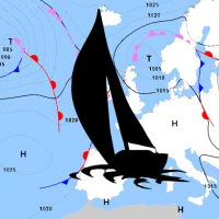
For proper planning of your sailing trip, information on meteo conditions are indispensable. The Sailtools Surface Pressure Charts App will give you a 5-day outlook on the possible developments of the large scale meteo conditions in Europe.
The maps have the purpose to merely supply you with large scale, longer term meteo info. To assess local actual conditions you will have to consult other sources.
To be able to download the charts in marginal internet connectivity conditions, the charts are supplied as low-resolution images, minimizing the file size.
Higher resolution images and zooming capability would suggest a reliability of the model outputs at a smaller scale. This has been discouraged by the meteorologists involved.
The app is light, fast and very easy to use. Morever it is free and without ads!
Features:
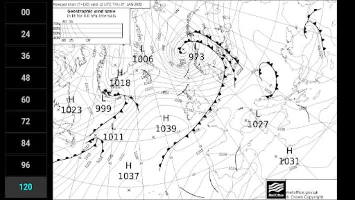
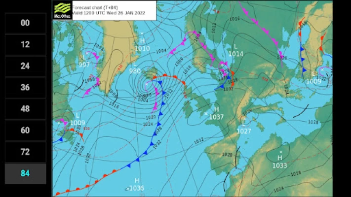
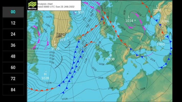
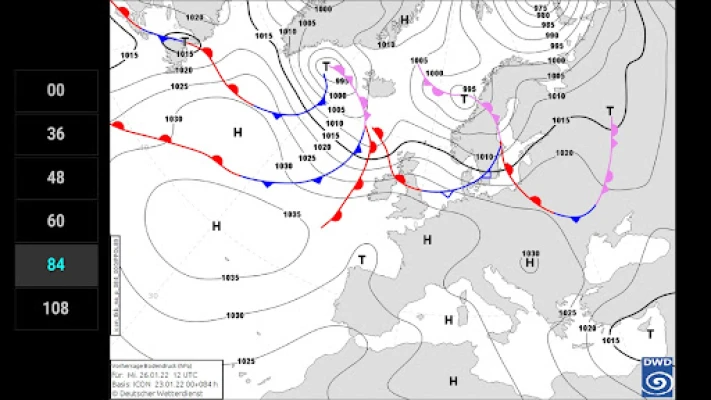
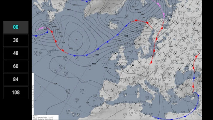
• DWD analysis for +00 and forecasts for 36, 48, 60, 84 and 108 hours
• UKMO analysis for +00 and forecasts for 12, 24, 36, 48, 60, 72, 84, 96 and 120 hours
• KNMI analysis for +00 and forecasts for 12, 24 and 36 hours
• isobars
• sea level pressure (hPa)
• frontal systems (heat and cold fronts and occlusions)
• thickness data (in UKMO B/W charts)
The charts are generated and generously made available by DWD, UKMO, KNMI and Wetterzentrale.de.
To be able to download the charts in marginal internet connectivity conditions, the charts are supplied as low-resolution images, minimizing the file size.
Higher resolution images and zooming capability would suggest a reliability of the model outputs at a smaller scale. This has been discouraged by the meteorologists involved.
The app is light, fast and very easy to use. Morever it is free and without ads!
Features:
• DWD analysis for +00 and forecasts for 36, 48, 60, 84 and 108 hours
• UKMO analysis for +00 and forecasts for 12, 24, 36, 48, 60, 72, 84, 96 and 120 hours
• KNMI analysis for +00 and forecasts for 12, 24 and 36 hours
• isobars
• sea level pressure (hPa)
• frontal systems (heat and cold fronts and occlusions)
• thickness data (in UKMO B/W charts)
The charts are generated and generously made available by DWD, UKMO, KNMI and Wetterzentrale.de.
Rate the App
Add Comment & Review
User Reviews
Based on 0 reviews
No reviews added yet.
Comments will not be approved to be posted if they are SPAM, abusive, off-topic, use profanity, contain a personal attack, or promote hate of any kind.
More »
Other Apps in This Category


More »

Popular Apps

The Feedback AppeKomi

Dragon King:fish table gamesDeeDeeFun

Saunders QA NCLEX PN Exam PrepSkyscape Medpresso Inc

Wonder for Dash & Dot RobotsWONDER WORKSHOP, INC.

Idle Zombie Miner: Gold TycoonRoyal Ark
WeGLOW: Home Workout for WomenWEGLOW APP LTD

Assault Lily Last Bullet WSO-NET ENTERTAINMENT TAIWAN LIMITED

Google AdminGoogle LLC

Goods Triple-3D Match GameMentha Games
MICAS - Shop Women's FashionMicasShop
More »
Editor's Choice
ConjuGato: Learn Spanish VerbsQotoQot

Crystalyze: Crystal ID GuideCrystalyze Media Inc.
Crystal Guide® Pocket EditionM.Stevens

Idle Obelisk MinerCheckbox Entertainment LTD

Marshall BluetoothMarshall Group AB
Idle Zombie Miner: Gold TycoonRoyal Ark

Woman`s WayimpulseCRM

Woman EvolveMighty Networks

Hilton Honors: Book HotelsHilton
Skyscanner Flights Hotels CarsSkyscanner Ltd